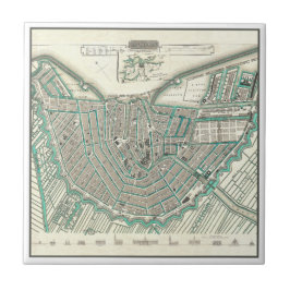
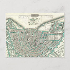
Amsterdam City Plan Map Collection
Unique Amsterdam home decor and gift ideas! This beautifully detailed city planning map is a high-quality image reproduction of the print originally drawn and engraved in 1835. Map was published in 1844 by Maps of the Society for the Diffusion of Useful Knowledge (Volume 1).
Supreme artwork details feature gorgeous aqua blue tones for the waterways, labeling of all major streets, landmark buildings, and parks. There's even line-art illustrations of the famous buildings along the bottom of the map. This print includes all original coloring; even the background is a photo-realistic antique paper visual texture!
5 resultados


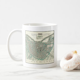
Taza De Café Amsterdam, los Países Bajos • Mapa antiguo del
Precio de venta 13,56 €. Precio original 15,95 €.
Otras colecciones de Dutch Inside que te pueden interesar